
|

|
||||
|
Landmarks ~
Churches ~
Pubs ~
Shops ~
Amenities ~
Dwellings ~
Events ~
Schools ~
Sports
Industrial ~ Transport ~ Folklore ~ Families
~ History ~
Old Maps
~ Aerial View 1962
~ Streets
~ Places
~ Typhoid Epidemic
~ Nailers
~ Snips
Census Enumeration ~ Bounds ~ Biblio ~ Sources
Place Names
Local place and street names described with their origins and descriptions.
1955: Birmingham Daily Post, 26 November.
Many place name meanings or origins are still obscure or inconclusive.
Those that are of interest are included, some ambiguous, others open to argument, this page will be a work-in-progress note-pad, and comments are always welcome.
Abbey Road and Abbey Street (Gornal Wood)
No records of an Abbey exists in the area, some say that land once belonged to an Abbey outside of the district, Abbey Farm which spread around this area was so named. The farm house was also referred to as 'The Old Abbey'.
Askew Bridge (Himley Road)
Askew Bridge possibly named due to the watercourse passing under the Himley Road at an oblique angle, the bridge is right on the Parish boundary and turnpike, although there are little signs of a bridge there now. This is also where the Askew Bridge toll house was sited in the 19th Century. A substantial body of water is shown at the Bridge on the 1844 Tithe map, the consequence of the dam formed at Coppice Mill downstream, the wooded area south of the Bridge was called 'Gornal Coppice'. A late 17th Century document refers to the pool as "Hunt's Pool". Due to the dam and sluice at Coppice Mill, the Askew Bridge Pool formed on the North side of the road too, and was shown on 19th Century maps. The pool was the scene of several drownings. Later a sluice was introduced at Askew, and the pool formed upstream of the bridge. During the early 20th Century, a tramway carried coal from mine workings at the Straits Green Colliery and crossed the road near Askew. On the north side of the bridge, one of the Earls' collieries sprang up in the 19th Century. A small wooded area now disguises the old spoil heaps. In the 17th Century Dud Dudley conducted experiments at what he called 'Hasco Bridge' here on producing Iron using pit coal, this was previously done using charcoal, he perfected and patented a process using coke produced from coal, rather than charcoal produced from wood burning. Hasco or Askew, how is this relationship? Askew Bridge was used as early as 1808 and 'John Askewe' is recorded in Sedgley Manor in 1576, as yet I have not seen any convincing explanation of 'Hasco'. Where Dud Dudley's furnace was actually built is open to conjecture, but it is possible that the pool was used as a source to power the furnace bellows and that the furnace was located on the opposite side of Himley Road, the furnace bellows being most likely water powered from the pools. Later, Askew Bridge Pool was drained, and apart from occasional flooding, only a swamp or marshy area can be seen at this location. Askew Bridge Road in Gornal Wood, despite the name, does not extend itself to Askew Bridge or anywhere near but perhaps it did at one time?
Barrs Meadow (Gornal Wood)
Thomas Barrs of Gornal Wood died in 1833 aged 72 years. It appears that he had previously bought land from the Earl of Dudley's estate, including this piece of land which is roughly the area below Stickley and as far as Gornal Wood village. Thomas Barrs the elder had a namesake son who was a farmer at Cotwall End, Mary Barrs owned the lands at Gornal Wood in 1844, the area was named after this family, Barr Street retains the place name. Gornal Wood village is sometimes referred to as the 'Meda' (meadow).
Bagley's Lane
This was later renamed Dibdale Lane and the Milking Bank housing estate built over the old opencast mining on the south side and the 'Black Country Forest' opposite. Bagley's farm was located on the rise at the top of Dibdale Lane, thus the lane was so named after the Bagley family who owned and farmed the surrounding land.
1882 Sale notice confirms the name change.
Black Wall (Gornal Wood)
Mentioned in 1841 Census within the Gornal Wood area, no further information.
Botany Street & Botany Bay (Ruiton)
This is a strange one, a great number of people lived in Botany Bay during the 1850-1870 period. Botany Street was an earlier name for Vale Street and Botany Bay, for Vale Row. It's likely that these streets were named after the newly named 'Botany Bay' in 1770 by Captain Cook, during his navigation of New South Wales, Australia. It is hard to imagine what relationship the two places had! By 1880, however the streets had been named Vale Street and Vale Row, even so, as this is one of the highest points in Gornal its hard to understand as to why 'Vale', perhaps because of the view into the Cotwall End valley below.
Brook Street (Gornal Wood)
This street got it's name from a gully that ran at the rear of the properties on the North side of the Street. The brook carried water and sewage from the upper reaches of Summer Lane, and onward to Musk Lane, where on the Western side an osier bed existed at the rear of the Fiddlers Arms. The brook is shown on a map as late as the 1930s, but the watercourse is likely to have been incorporated into the mains sewer system after this.
Cooper's Bank
A second turnpike was located on the eastern end of Himley Road at Cooper's Bank, Cooper's Bank Farm possibly dates back to 17th Century, the area could have taken it's name after a family or perhaps the cooper trade.
Cricket Meadow (Upper Gornal)
It's hard to imagine a meadow that would be flat enough for a game of cricket in this area, and no real association found with the game. Upper Gornal did have a cricket team as early as the 1850s, but this was probably based on what is now the Upper Gornal Recreation Ground near the windmill where fetes were held. The name could originate from a meadow where grasshoppers were plentiful which are often confused with the less common 'Cricket'. A Tithe piece (1844) was called "Cricket Meadow" in this vicinity. Cricket Meadow would have been part of farmland belonging to Roberts Green Farm. The area was also extensively quarried, by 1961 the present council estate was created here and a street in the locality is named 'Cricket Meadow'.
Dibdale
Dibdale Bank, an area near to the Black Bear public house This is a corruption of 'Deep Dale', Deepdale Lane also known as Dibdale Lane. Renown for the large Gibbons works on Dibdale Road which produced firebricks and retorts from the local clay.
Diddlers Lane
Obscure one, thought to be flanking the Himley Road somewhere between Askew and Summit Place, perhaps an earlier name for Flavells Lane.
Ellowes (Lower Gornal)
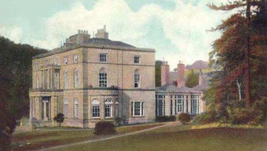
In the early 19th Century, referred to as 'Ellers', and still pronounced so by locals, takes its name from 'Ellen Valle' (Valley). A document describing the Sedgley Manor estate of Roger de Somerly, 1272, mentions 'Ellenvale', "... the house and gardens of Ellenvale are worth yearly 2s". [Sedgley Researches (1892) - Frederick W. Hackwood] Ellen Valle is marked on an eighteenth century map of 'Gwarnell' as an area running along the low lying area of the Cotwall End valley or 'dingle' which the later Ellowes Hall overlooked. 'Ellen' appears to have Anglo-Saxon origins, possible meaning; Elder (as in the bush or tree), the fruit of the Elder was used for making wine and Elder is still plentiful in the valley. Ellowes Hall was reputedly built on the site of 'Ellen Vale' cottage. Road names; Ellowes Road, Ellowes Row and The Ellowes School built in the 1960's are named so.
Fiddler's Lane (Lower Gornal)
Fiddler's Lane was mentioned in the 1851 Census and this appears to have been the original name of what was to become 'Humphrey Street', in 1861 Census it is referred to as "Fiddlers or Humphrey's Lane".
The Graveyard (Lower Gornal)
On the eastern side of Gornal, an old Quaker burial ground with burials recorded 1780 -1790, the area later became extensively mined, one of the ventures named 'Graveyard Colliery'. A small community grew here during these times, by 1901 they had their own Chapel Room. Graveyard Road had its name changed to Grosvenor Road sometime in the 1930s. Graveyard Farm is shown on old Ordnance maps.
The Greens (Lower Gornal)
The Five Ways may still be referred to as 'The Green' by older folk, although as yet no one has come forward with a proper explanation. The farm in the upper part of Robert Street, was called Roberts Green Farm and land adjacent called Roberts Green, the area between the farm and the Five Ways was mostly farm land in the mid 19th Century, so this could be the connection. Roberts Green Road is a relatively modern street between Jews Lane and Pale Street.
Jews Lane and Jones Lane. (Upper Gornal)
Jews Lane is mentioned in both 1851 and 1861 census which sort of discounts the theory of a corruption of Jones Lane which co-existed. Originally 'Jews' is thought to have developed from the surname Jones and not from any religious context, 'Jones Lane' existed in the 1861 census and in some documents as 'Hoping Jones Lane'. People living in Jones Lane in 1861 were found in Deepdale Lane in the 1871 census, Deepdale Lane is not found in the 1861 census and possibly Jones Lane extended from the Five Ways towards the main Dudley road in one form or another. Jones is pronounced locally as Jewns' or 'Jewuns'. Jews Lane originally ran towards Deepdale Lane and onwards to Graveyard Road (Grosvenor Road), Robert Street, previously only a track, appeared after 1881 taking a course to the Five Ways and subsequently becoming a main thoroughfare, it seems likely that Hoping Jones Lane was in fact this old track. In a conveyance deed dated 1901:- "All that parcel of land situated in Robert Street (formerly known as Hopping Jones Lane), Lower Gornal and bounded on the front by Robert Street".
Jim Crow (Gornal Wood)
Mentioned in 1861 Census, but found little other reference to it, several families lived there at that time, thought to be in the vicinity of Bull Street.
Lake Street (Lower Gornal)
There is no signs of a pool or lake here but at the eastern end, the ground has topography perhaps from open-cast mining that would support a body of water at some time past, but no real evidence found except a couple of nearby water-filled workings in the 1840's. In the 1861 census it was called Lake Lane, however it could well have been a mistake of the enumerator, in the 1851 Census, the 'the road to the Lake' was mentioned by the enumerator.
Louise Street (Gornal Wood)
Why the one time so called 'High Street' became Louise Street is unknown, some documents suggest that Louise Street was named before 1870, but who 'Louise' was remains uncertain. In 1851-1861 Census this part of Gornal which really hadn't developed into a 'Street' was called Cock Pit Lane. The only argument I can offer, is that it was named after Princess Louise, born in 1848, she was the sixth child of Queen Victoria, and a popular Royal. She was engaged to the Marquess of Lorne, in 1870 so would have been in the public eye at that time, so fits in nicely.
Masons End (Gornal Wood)
Often referred to in the mid-19th Century, this appears to be in the general area of central Gornal Wood around about the White Chimneys Inn in Abbey Road, in the 1844 Tithe, a large dwelling and land South side of what is now Louise street was owned by the Mason family but equally could have been so-named relatively after the numerous stone masons who built much of Gornal at the time from the sandstone of local quarries.
Milking Bank
A mid-nineteenth century Tithe map shows a meadow called 'Milking Bank' in that area.
Musk Lane (Gornal Wood)
On the west side of Musk Lane, which is now Orchard Grove, a natural bowl in the landscape formed a sewage swamp. A small gulley channeled foul water and sewage from houses in the upper reaches of Summer Lane. The gully continued along the rear of houses in Brook Street and across the gas works site, and fed the swamp. Until the area had a proper sewerage system in the late 1920's, there would definitely be a 'musk' in the vicinity.
Redhall - Red Hall (Lower Gornal)
A small mining community grew up around East Street and West Street adjoining Redhall Road and is known as Redhall. In the early nineteenth century it was often marked on maps and documents as 'Red Hall', it was still called 'Red Hall' in the 1851 Census, however no 'Hall' ever existed here. It is thought 'Redhall' was probably a local corruption of 'raddle' also called 'reddle'. Raddle, a form of red ochre, was often dug in early mining operations, directly from a raddle pit or more likely as a by-product of clay or coal mining, and there were certainly old mines at Redhall. Raddle was actually an oxide of Iron, being a hard reddish earthy material often sandwiched in clays and marls. The raddle mixed with oils was used for the raddling of sheep. This usually reddish dye would be daubed onto a rams belly during the mating season, the tups (female sheep) were thus marked during mating. With Redhall being near to the old drover road from Mid-Wales, further increases the possible connection.
Ruiton - Rewardine (Upper Gornal)
Ruiton was derived from 'Rewardine' which is an old name for this elevated area of Upper Gornal. There are various theories on this place name but nothing conclusive. There were many inconsistencies in the earlier spelling; e.g. Rowerton, Rewarton, Rewarden. The first part may derive from the Welsh 'Rhiw' - 'a slope or hillside' which fits the topography. 'Wardine' derives from an Old English word denoting an enclosure, such an enclosure could be an extended property, farmstead, etc.
1835 Sale Notice.
Sheepcotwall (Upper Gornal)
An early name for the Kent Street area of Upper Gornal, usually presented as one word. A sheep cot, is an enclosure or pen for sheep and other livestock.
Stickley (Lower Gornal)
This was another tithe piece 'Stickley Field', meadow land around the Stickley and Ellowes area. Most likely derived from the Old English/Anglo-Saxon 'stickle' meaning steep and 'lea', an open area of arable land, this fits in neatly with the topography of this particular area. Stickley Lane and Stickley Estate keep the tithe name alive.
The Straits.
It is thought that this is derived from the Old French 'estreit' meaning a narrow passage. It's not completely clear how this applies to the area geographically, unless it refers to the Cotwall End valley. "Streight" as it was sometimes written on old documents and maps, in Anglo Saxon, a Roman road was called a 'Streat', although there is not much evidence of Roman activity in the Gornal district. Notable are: Straits House; Gordon's Place; Straits Farm. The whole area was developed between the 1960s and 1970s into a large housing estate.
Straits Green.
The lower part of the Straits near Cotwall End Road is so-named. The area yielded a great deal of coal in the 19th and early 20th Centuries and a mining community grew up around this area. See: Mining; Straits Green Mission.
Summer Lane - Spout Lane - Smout's Lane. (Lower Gornal)
There are early references to Smout's Lane in the 1851 and 1861 census which ran down this steep route. Some of the older folk remember Summer Lane as 'Spout Lane'. There were two 'cisterns' near the top of Summer Lane, in this instance a cistern was an open stone lined well, there is a report that someone was drowned in one of the cisterns. There was no fresh water piped into Lower Gornal until the 20th Century and the cistern would have been the local source of water, it was often contaminated with sewerage from local housing, and resulted in many illnesses and deaths. See Dr. Ballentine's Sanitary Report for Lower Gornal in which he describes the Typhoid epidemic, of which the cisterns in Summer Lane were partly to blame. No doubt this brought about the attraction of the beer houses and preoccupation of brewing in the district. Unsure why this became known as Summer Lane, but this name dates back until at least the 1875.
Tailors Bank (Gornal Wood)
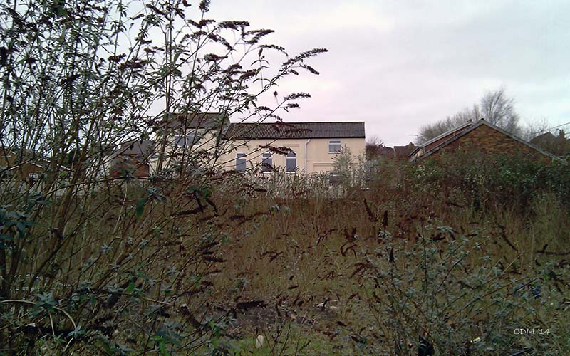
Mentioned in 1841 Census within Gornal Wood area, no further information. 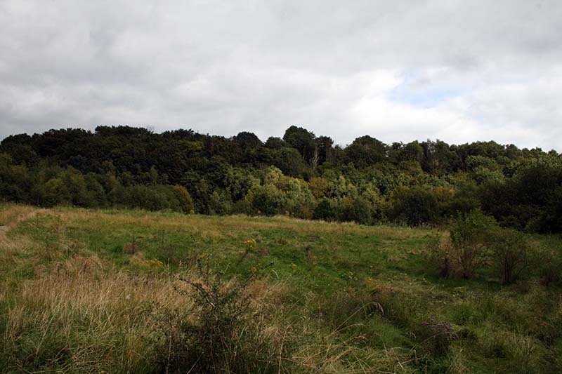 View of Turners Hill from Cotwall End. View of Turners Hill from Cotwall End.
Turners Hill (Lower Gornal)
Turner was a well-known local name which has been lent to several roads and streets, it seems likely that at one time the Turner family were the tenant or landowner of this piece. It can be confused with like-named Turners Hill at Rowley Regis - on the other side of Dudley. The highest point of Turners Hill nears six hundred feet above sea level and of geological significance, the steep western slopes of the hill can still yield fossils in the limestone, there are also strata of sandstone, clay and coal. Turners Hill Wood wraps around the southern and western slopes of the hill, the fields that once existed on the higher points, made way for a new housing estate built in the 1950s, along the newly formed Park Road and Turners Hill Road. The Cotwall End valley below Turners Hill was extensively mined in the early 20th Century. Much of the wood still remains and now forms part of a nature park, extending to Cotwall End.
Wobbers Bank.
Mentioned in the 1851 Census and other documents of the period, appears to have been in the vicinity of Himley Road/Bull Street/Kettles Bank around about the Bulls Head Inn. ~
|


|
|||

 *NEW*
*NEW*